Publication & Certificates
Publication
1. (submitted) Guo, M., Gong, J., Ro, S., Nenad, G., Ali, Maher. The impact of Environmental Factors on the Validity of Infrared Thermography Evaluation of Concrete Bridge Decks, submitted to Automation in Construction.
Learn more
2. (submitted) Guo, M., Gong, J., Yu Y., Senick J., Andrews J. Spatially Resolved Infrared Imaging for Building Performance Evaluation, submitted to Building and Environment.
Learn more
3. Guo, M., Gong, J., & Whytlaw, J. L. (2022). Large-scale cloud-based building elevation data extraction and flood insurance estimation to support floodplain management. International Journal of Disaster Risk Reduction, 69, 102741.
Learn more
4. Guo, M. (2021). Hurricane Ready Cloud (HRC): an ecosystem of connected sensors, data, tools, and users for resilient coastal communities (Doctoral dissertation).
Learn more
5. Zhang, T. T., Guo, M., Jin, P. J., Ge, Y., & Gong, J. (2020). Longitudinal-Scanline-Based Arterial Traffic Video Analytics with Coordinate Transformation Assisted by 3D Infrastructure Data. Transportation Research Record, 0361198120971257.
Learn moreSee TRB Poster
6. Thomas, N., Calderön, L., Senick, J., Sorensen-Allacci, M., Plotnik, D., Guo, M., ... & Mainelis, G. (2019). Investigation of indoor air quality determinants in a field study using three different data streams. Building and Environment.
Learn more
7. Wang, Z., Hu, H., Guo, M., & Gong, J. (2019). Optimization of Temporary Debris Management Site Selection and Site Service Regions for Enhancing Postdisaster Debris Removal Operations. Computer‐Aided Civil and Infrastructure Engineering, 34(3), 230-247.
Learn more
8. Guo, M. (2016). Spatially resolved infrared imaging for building performance evaluation.
Learn more
9. Zhou, Z., Gong, J., & Guo, M. (2015). Image-based 3D reconstruction for posthurricane residential building damage assessment. Journal of Computing in Civil Engineering, 30(2), 04015015.
Learn more
10. Working on:Building a Cloud-based Data Collaboratory for Hurricane Damage Assessment
Learn more
11. Working on:Cloud-based Virtual Hurricane Damage Assessment with Multi-Sourced Disaster Data
Learn more
Certificate and Awards
1. AWS Certified Machine Learning Specialty - 2022
See Certificate
Learn more
2. AWS Certified Solution Architect Associate - 2022
See Certificate
3. 2019 fall -2020 spring: NSF Graduate Research Fellowship
Learn more
4. 2019 ASCE Computing Division: Best Presentation Reward
See Reward
5. FLIR Level I Infrared Thermographer
See CertificateLearn more
Presentation and Seminar
1.9/15/2020 Bentley Applied Research Seminar 2020(2:00pm - 4:00pm, Tues)
Convergence of Sensing, Data and Analytics, Infrastructure Design/Engineeering, and Huamn Studies for Resilient, Health, and Equitable Communities. Dr Jie Gong and Mengyang Guo
Seminar Photo
2.3/30/2020 - 4/3/2020 ADCIRC Week in Baton Rouge, La
2020 ADCIRC Week in Baton Rouge, La
3. 1/25/2020 Rutgers Geology Museum 52nd Annual Open House
Immersive Exploration of Coastal Coummunities in a Changing Climate
4. 1/13/2020 TRB: CCTV Traffic Video Analytics with Fast Recalibration Assisted by 3D Infrastructure Data
TRB 2020: CCTV Traffic Video Analytics with Fast Recalibration Assisted by 3D Infrastructure Data
See TRB Poster
5. 11/6/2019 Public Informatics Seminar, Rutgers Bloustein School, room 170 10:00 am
LiDAR and Computer Vision in Urban Planning
6. 10/15/2019 NJAFM 15th Annual Conference
FEMA Rebuilding with Greater Resiliency Project
7. 9/17/2019 Bentley Seminar: Digital Twins for City Infrastructure
Building Digital Twins for Future Communities
8. 6/17-19/2019 The 2019 ASCE International Conference on Computing in Civil Engineering: Future Cities and REsilient Infrastructures
Building a Cloud-based Data Collaboratory for Hurricane Damage Assessment
Meeting Info
Best Presentation Reward 2019
9. 10/17/2017 NJDOT Research Showcase
Web-based/ Immersive Visualization of Bridge Condition data from multiple sources to support transportationn asset management: Click to View
Event Photo
10. 2017 Annual Meeting of Command, Control & Interoperability Center for Advanced Data Analysis
Inundation Risk Information System (IRIS) Viewer: Click to View
Meeting Info
11. 10/20/2016 NJDOT Research Showcase
Web-based Visualization of Bridge Condition Data from Multiple Sources to Support Bridge Condition Evaluation: Click to View
1. AWS Certified Machine Learning Specialty - 2022
See Certificate1.9/15/2020 Bentley Applied Research Seminar 2020(2:00pm - 4:00pm, Tues)
Convergence of Sensing, Data and Analytics, Infrastructure Design/Engineeering, and Huamn Studies for Resilient, Health, and Equitable Communities. Dr Jie Gong and Mengyang Guo Seminar Photo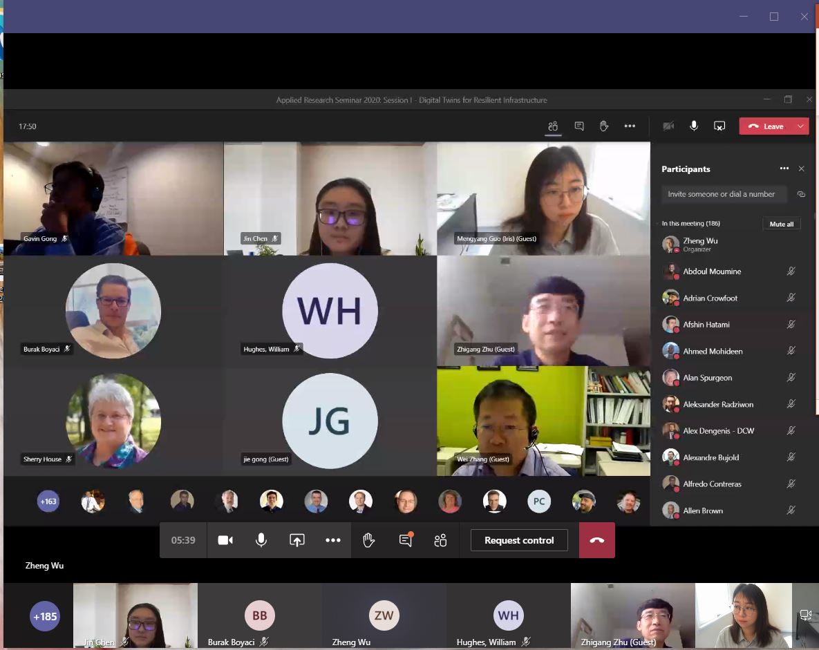
2.3/30/2020 - 4/3/2020 ADCIRC Week in Baton Rouge, La
2020 ADCIRC Week in Baton Rouge, La3. 1/25/2020 Rutgers Geology Museum 52nd Annual Open House
Immersive Exploration of Coastal Coummunities in a Changing Climate4. 1/13/2020 TRB: CCTV Traffic Video Analytics with Fast Recalibration Assisted by 3D Infrastructure Data
TRB 2020: CCTV Traffic Video Analytics with Fast Recalibration Assisted by 3D Infrastructure DataSee TRB Poster
5. 11/6/2019 Public Informatics Seminar, Rutgers Bloustein School, room 170 10:00 am
LiDAR and Computer Vision in Urban Planning6. 10/15/2019 NJAFM 15th Annual Conference
FEMA Rebuilding with Greater Resiliency Project7. 9/17/2019 Bentley Seminar: Digital Twins for City Infrastructure
Building Digital Twins for Future Communities8. 6/17-19/2019 The 2019 ASCE International Conference on Computing in Civil Engineering: Future Cities and REsilient Infrastructures
Building a Cloud-based Data Collaboratory for Hurricane Damage AssessmentMeeting Info
Best Presentation Reward 2019
9. 10/17/2017 NJDOT Research Showcase
Web-based/ Immersive Visualization of Bridge Condition data from multiple sources to support transportationn asset management: Click to View Event Photo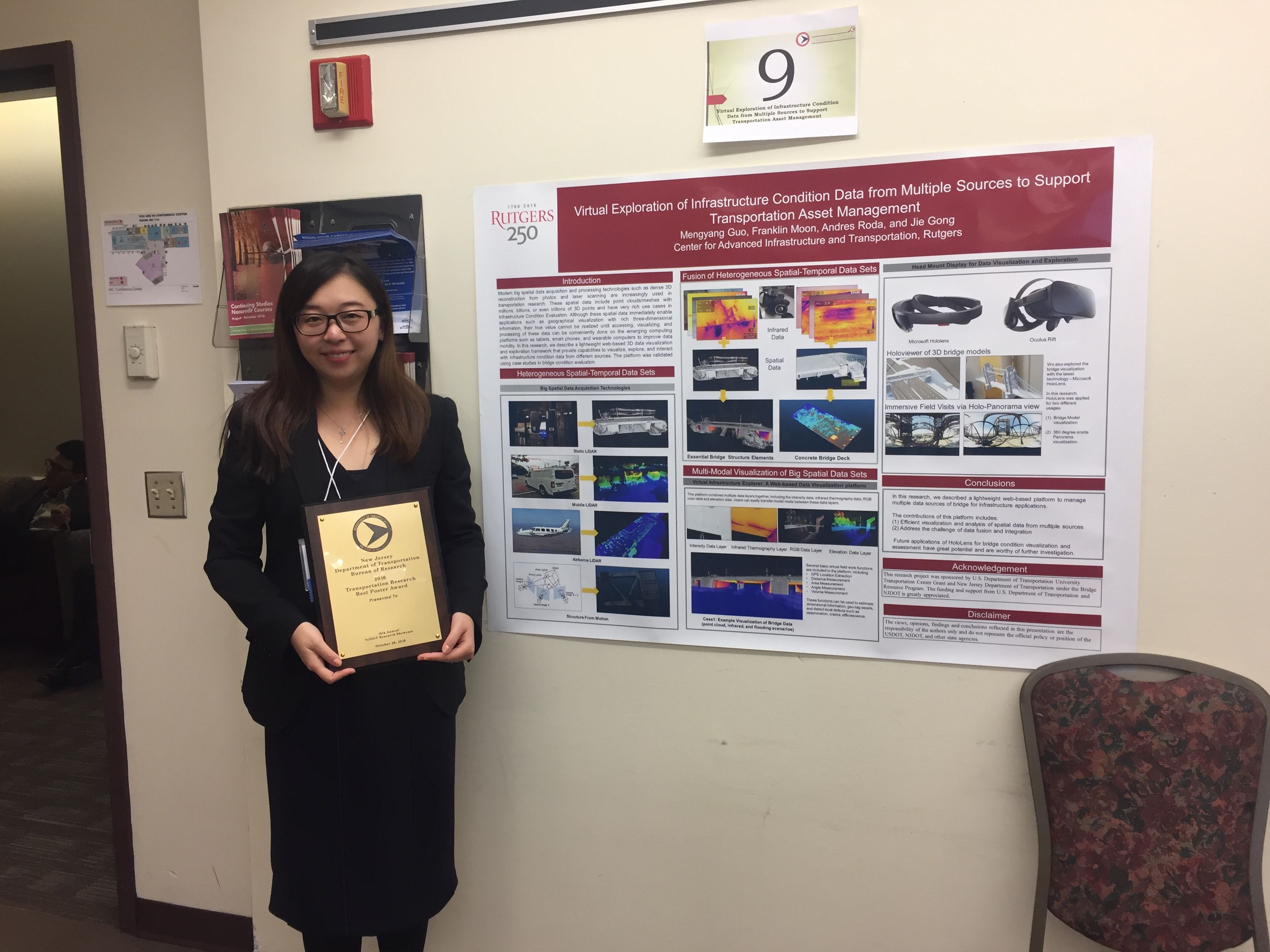
10. 2017 Annual Meeting of Command, Control & Interoperability Center for Advanced Data Analysis
Inundation Risk Information System (IRIS) Viewer: Click to ViewMeeting Info